Planning Department
7121 East Loop Road
Stevenson, WA 98648
Mailing Address
PO Box 371
Stevenson, WA 98648
Phone: 509-427-5970
Email: planning@ci.stevenson.wa.us
An early target of Stevenson’s Critical Areas Ordinance review and update, the hazards associated with Frequently Flooded Areas are easy to understand. Generally, flooding is a natural cycle of streams and rivers. It occurs when the volume of precipitation or melting snowpack exceeds the capacity of river banks to keep flowing waters contained. These system-wide events can take lives and destroy property. The small city of Vernonia, Oregon represents a worst-case scenario, where successive flood disasters inundated the community’s neighborhoods, businesses and schools. Ultimately, the community responded with a fundamental reorganization of its urban fabric, and the community’s elementary, middle, and high schools were all moved to higher ground.
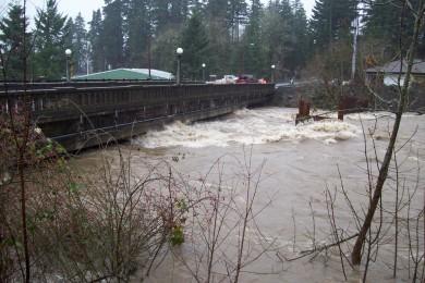
Stevenson is protected from many of these system-wide events by the Bonneville Dam, which has already inundated much of the Columbia River’s historic floodplain. Instead, our flood threats occur mostly along Rock and Kanaka Creeks and at other localized hazards such as blockages within a stormwater system or log jams caught on bridges.
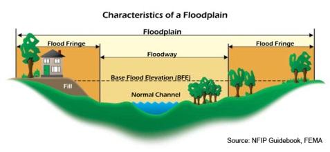
To further reduce Stevenson’s vulnerability to flood hazards, the City reviews all projects within floodplains according to its 1990 Floodplain Management Regulations. Typical of the model regulations promulgated at that time, these rules are applied to all proposals within the Special Flood Hazard Areas established by the Federal Emergency Management Agency (FEMA). Flood Insurance Rate Maps (FIRMs) of these areas were established in 1986 for the City and County. General standards applied during these reviews provide ways for subdivisions, utilities, and construction to avoid being unnecessarily disabled during floods. Specific standards are then also applied to residential construction, nonresidential construction, manufactured homes, and recreational vehicles. These standards largely focus on ensuring the lowest floors of buildings are located above base flood elevations and any structure below that elevation will resist the force of floodwaters. These regulations were reviewed and found to be adequate during both the 2003 adoption and the 2008 update of Stevenson’s Critical Areas Ordinance.
Staff has taken a 3-pronged approach to evaluate whether the City’s current efforts are effective or in need of amendment. These efforts focus on 1) past trends of the flood insurance claims and losses by Stevenson’s property owners, 2) the likelihood of future changes to FEMAs floodplain maps, and 3) the consistency of Stevenson’s regulations with similar state and federal laws.